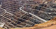
AGRICULTURE
Our geosystems technologies from Leica and Sigma Space enable you to capture real world data and turn it into a 3D digital replica.
The geospatial digital twin - a digital replica of a real-world feature - is the keystone connecting information to help provide situational awareness. Hexagon US Federal provides the necessary data collection tools, enabling the US Government to build the most comprehensive and accurate digital replica to meet their needs.
Aerial sensors provide the ability to map large areas effectively. Whether your need is EO, LiDAR or both, Hexagon US Federal has the right tools. Our Leica ADS100 or Leica DMC III large format imaging sensors are among the best in the industry. Both have the capability to map in the visible and near infrared portions of the electromagnetic spectrum. Where they differ is what allows you to select the right tool for the mission.
The Leica ADS100 is a push-broom technology, creating an image carpet as you fly. Currently, the Leica ADS100 is the sensor of choice on the largest, Federally-funded national mapping program.
With the ability to capture imagery as small as 2 cm, the Leica DMCIII is a framing sensor, for traditional large-scale photogrammetric applications.
Unlike EO imaging systems which are passive sensors, Airborne LiDAR are active and therefore can be used day or night. Nighttime surveillance missions may be advantageous for a number of reasons such as less solar noise interference or the need to be covert. Hexagon US Federal can provide the Leica TerrainMapper II, Leica CityMapper II or the Sigma Space SPL100 LiDAR systems, each of these having a unique mission application in mind.
Further extending the capabilities of our LiDAR sensors is the ability to couple them with imaging technology.
The Leica MFC150, medium format sensor can be added to the LiDAR sensors. In the case of the Leica TerrainMapper II or Sigma Space SPL100, a single, nadir oriented EO camera, and in the case of the Leica CityMapper II, five sensors, one a nadir and four oriented at a 45 degree off nadir attitude for 3D mapping.
Hexagon US Federal can also address your needs to map the Littoral zone. With a full complement of airborne bathymetric LiDAR sensors, mapping from the coast to 3 Secchi Depth is achievable.
Hexagon US Federal has a complete line of terrestrial based high definition scanning (HDS) sensors for creation of a digital twin.
Our Reality Capture tools range from portable hand-held scanners to over 1 km.
The Leica BLK2GO is a perfect example of a tool for mobile, high definition scanning. With a laser range of 30 meters, capable of pulsing at 420,000 times/second combined with high resolution imagery, your surveyor can quickly and efficiently gather 3D point cloud information of your building interior.
The Leica RTC360, with its revolutionary VIS system, 2 million points/second, 130 m range and High Dynamic Range (HDR) imaging, makes this one of the fastest and most accurate HDS scanners on the market.
If safety and accuracy are a primary concern, the Leica P50 scanner is ideal. With a maximum ranging capability of over 1 km, the P50 is ideal for keeping surveyors out of harm’s way.
Hexagon US Federal’s Digital Twin, Reality Capture tools don’t stop at aerial and terrestrial, we also offer a vehicle agnostic, mobile mapping system, the Leica Pegasus Ultimate II as well as a full line of Ground Penetrating Radar sensors.
When your mission charter requires accurate data for the construction of a digital twin, Hexagon US Federal is unique to all others that we have you covered from the air, to land and sea as well as subterranean.
For more information on our Airborne & Terrestrial Sensors or for a quotation, contact us today.