AGRICULTURE
We provide a rich set of solutions for your remote sensing, photogrammetry and GIS needs, including ERDAS IMAGINE, the world’s preferred remote sensing software package, ImageStation for large-scale mapping and ortho production requirements, and M.App X for a 100% cloud-based geospatial intelligence exploitation solution.
For more information on our Solutions for Remote Sensing and Photogrammetry, contact us today at info@hexagonusfederal.com
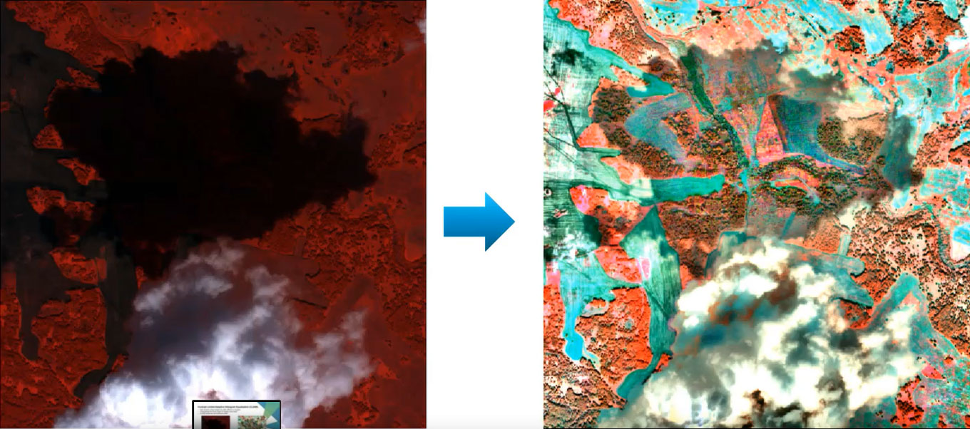
ERDAS IMAGINE consolidates remote sensing, photogrammetry, LiDAR analysis, basic vector analysis, and radar processing capabilities.
ERDAS IMAGINE simplifies image classification and segmentation, orthorectification, mosaicking, reprojection, elevation extraction, and image interpretation
ERDAS IMAGINE offers K-Means, ISODATA, object-based image segmentation, Machine Learning and Deep Learning Artificial Intelligence algorithms
ERDAS IMAGINE fully enables the display, editing, and analysis of point clouds derived from LiDAR or point correlation of stereo pairs.
The Spatial Modeler’s graphical editing environment and rich set of operators provides flexibility to capture domain expertise and create re-usable models that can be shared with others.
The ImageStation suite enables digital photogrammetry production workflows, including project creation, orientation and triangulation from aerial and satellite imagery. It provides stereo GIS feature collection and editing, digital terrain model (DTM) collection and editing, as well as orthophoto production and editing.
ImageStation is specially designed to move large quantities of raw spatial information to an actionable or exploitable format for government, commercial photogrammetry, and mapping agencies worldwide.
To learn more about ImageStation, visit Hexagon Geospatial’s product page: ImageStation | Hexagon Geospatial
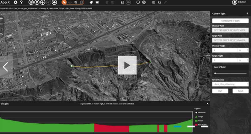
M.AppX is a cloud based exploitation solution that provides analysts and other intelligence professionals with vital functionality for executing a full range of tasks through a 100 percent browser-based, zero-footprint architecture.
Learn more about Hexagon Geospatial’s product page.