HEXAGON
Hexagon's Divisions
Explore Hexagon
AGRICULTURE
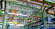
ASSET LIFECYCLE INTELLIGENCE
AUTONOMY & POSITIONING
GEOSYSTEMS
Hexagon Geosystems
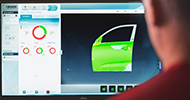
MANUFACTURING INTELLIGENCE
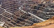
MINING
Safety, INFRASTRUCTURE & GEOSPATIAL
XALT SOLUTIONS
Explore All
Explore Hexagon
OUR STORY
SOLUTIONS
SUSTAINABILITY
Learn More
What We Do
Solutions
Geospatial Intelligence, Mapping, and Remote Sensing
Autonomy and Positioning
Airborne & Terrestrial Sensors
C5ISR
Security Solutions & All-Hazards Management
Enterprise Information Management Solutions
Cybersecurity Engineering and Support Services
Product Lifecycle Management (PLM) Support Services
Electronic Record Management Solutions
Software and Systems Engineering Solutions
Engineering IT Support Services
Rugged Hardware Engineering Services
3D Models for Concept Development
Products
Geospatial and Content
Solutions for Remote Sensing and Photogrammetry
Cartographic Web Services
GeoMedia
Luciad Portfolio
Develop Web-based and Mobile Geospatial Apps
GEEP | Google Earth Enterprise Platform
ARTEMIS (Aerial Reconnaissance Tactical Edge Mapping Imagery System)
Geospatial Content
Autonomy and Positioning
Antcom Antennas
GPS/GNSS Receivers
GPS Anti-Jam Antenna Technology – GAJT™
GRIT
Aerial Imaging
Large Format Mapping Sensors.
City Mapper
Detection Systems
Pegasus II Ultimate Mobile Mapper
FLX 100 Plus
Ground Penetrating Radar Technologies
Laser Scanning
Airborne LiDAR Sensor Technology
Airborne Bathymetry Technologies
Reality Capture Technology
Mobile Mapping Technology
Simulation and Modeling Software
All-Hazards Capabilities
Enterprise Information Management Products
JCMIS Product Lifecycle Management (PLM) Tool
SmartRMF™ - Managing the RMF Process
Rugged Hardware
Modular Building Solutions
Enterprise Asset Management (EAM)
Case Studies
Work With Us
Careers
Open Positions
Government Contracts
Industry Certifications
VALOR: Veterans & Allies
About Us
In the News
Trainings and Talks
Conferences and Events
Board
Leadership Team
Our People
Corporate Philanthropy
Our Story
Contact Us
Customer Support
Title Ipsum Lorem Doloret